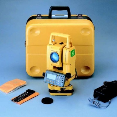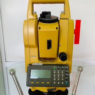
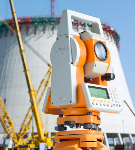
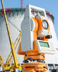

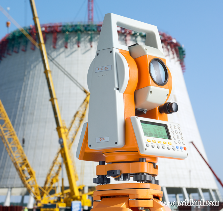
Alat Survey - Total Station Geo Fennel TheoDist FTD 05
Perhatian!
Spesifikasi Alat Survey - Total Station Geo Fennel TheoDist FTD 05
Detail Produk Total Station Geo Fennel TheoDist FTD 05
Description :
Total Station Geo Fennel TheoDist FTD 05
Reflectorless Construction Tachymeter
The geo-FENNEL TheoDist® is an instrument designed to be easy to use and quick to set up on any construction site. Inexperienced users and professionals alike will benefit from the menu driven software with its intuitive structure and
function keys improving productivity and saving valuable time. The principle features of the geo-FENNEL TheoDist® are:
· Measuring programs that provide efficient and easy solutions for setting out.
· Reflectorless measurement makes inaccessible target positioning a thing of the past.
· Three-dimensional measurement of coordinates.
· Menu driven software with intuitive structure to maximize productivity.
· A visible laser pointer to improve targeting accuracy and allowing measurements to be taken without looking through the telescope.
· Data can be uploaded and downloaded to a PC via the RS232 connection.
· Quick and easy set-up with the integrated laser plummet.
· Measuring range of up to 200 m without a refl ector and 600 m with a reflector.
The geo-FENNEL TheoDist® is equipped with a variety of programs from simple distance and angle measurement up to precise three-dimensional setting out:
Coordinate: Measuring and working in a three dimensional coordinate system.
Missing Line: Calculation of the slope distance, horizontal distance and vertical height difference between two measured points.
Offset: Calculates the distance and angle to a point you want to measure by positioning the target in front, behind or perpendicular to the line of sight.
REM: Measures the height to an object by indirect measurement when a direct measurement is inaccessible.
Resection: Determines the coordinates of the instrument by measuring multiple known points. The instrument can determine its position from a minimum of two to a maximum of 10 known points.
Area: The area can be calculated by measuring its perimeter with a minimum of three points.
The communication software supplied with the geo-FENNEL TheoDist® allows the user to save the data in various formats. The data fi les can be converted into DXF format making them suitable to be uploaded into CAD Software such as AutoCAD.
Features :
* With laser pointer for targeting
* Integrated laser plummet for quick and easy setting up over a ground point
* Narrow laser beam for precise targeting and measuring
* Electronic compensation system for monitoring the system levelling and elimination of levelling errors
* Internal memory for 50.000 points
* Easy user defined alphanumeric function keys (26 buttons only)
* NiMH rechargeable batteries
Technical data
| Telescope | |
| Image | erect |
| Objecitve aperture (EDM) | 45 mm |
| Magnification | 30 x |
| Field of view | 1° 30′ |
| Resolving power | 4” |
| Shortest focussing distance | 1,5 m |
| Distance measurement | |
| Refl ectorless | 1 bis 200 m |
| Flat prism FP 50 | 1 bis 600 m |
| Reflective tape target RS | 1 bis 600 m |
| Single standard prism 62 mm | 1 bis 600 m (Offset = 0) |
| Accuracy | 3 mm + 2 ppm |
| Measuring time | |
| (fine / rapid / tracking) | 1,5 s / 0,9 s / 0,3 s |
| Minimum reading | 1 mm |
| Units | ft / m |
| Angle measurement | |
| Minimum reading resolution steps | 1” / 5” / 10” |
| Accuracy | 5” |
| Angle units | 100 % / 360° / 400gon |
| Compensator | |
| Type | electronical |
| Range | ± 3° |
| Laser Pointer | |
| Laser class | 3R |
| Laser plummet | |
| Accuracy | ± 1 mm / 1,5 m |
| Laser class | 2 |
| Display | |
| Dual LCD | 4 lines, 24 characters |
| Power supply | |
| Rechargeable battery | 7,2 V DC NiMH |
| Operating time | 5 h |
| Charger | 100/240 V |
| Vial sensivity | |
| Plate level vial | 30” / 2 mm |
| Circular vial | 8′ / 2 mm |
| General | |
| Internal memory capacity | 50.000 Points |
| Weight (instrument) | 6,0 kg |
| Operating temperature | -20°C bis +50°C |
| Dust / water protection | IP 54 |
| I/O-Port | RS-232 |
Mitra Geologi