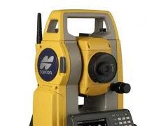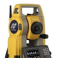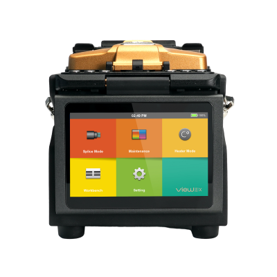
Highly functional total station with outstanding operability
- Windows® CE is ready in a lightweight, compact body
- MAGNETTM Field On-Board Application Software
- Fast and Powerful Reflectorless EDM
- LongLink Data Communication*
- Advanced Angle Measurement System
- Long-lasting battery
- Rugged and User-friendly Design

Before using the OS series, it is necessary to perform the user registration.
Please click here and read the registration manual.
Windows® CE is ready in a lightweight, compact body
 Windows® CE provides a familiar, comfortable operating environment.
- Completely new onboard application “MAGNETTM Field” is installed as standard feature.
MAGNETTM Field On-Boad Software


Powerful on-board software that covers full functions for surveying and engineering tasks. MAGNET™ Field handles data collection, stake out, roads and coordinate geometry.
Fast and Powerful Reflectorless EDM
- Fast and accurate pinpointing with phase shift technology.
- Fast distance measurement of 0.9s regardless of object.
- Minimum reflectorless measurment distance - just 30cm.
- Improved collimation with super-bright laser pointer.
- Smaller EDM beam spot size for minimal distance measuring error.
- Dependable measuring even at shallow incidence angles.
- Ensures accurate reflective sheet distance measurement.
- IP66 dustproof/waterproof performance.
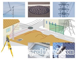
The ultra-narrow EDM beam can precisely measure walls, corners, manholes on the surface, even chain-link fences and tree branches.
LongLink Data Communication*
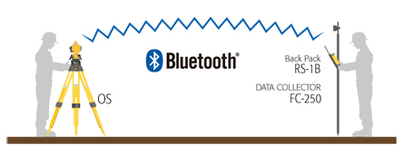
- Bluetooth® Class1 communications ensures a long-distance, stable connection.
- Link between total station and rover-end data collector, both equipped with Bluetooth Class1, facilitates quicksurveying only by sighting the object.
* Option

Advanced Angle Measurement System
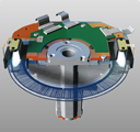
- OS features advanced absolute encoders for long-term reliability in all work conditions.
- Dual-axis compensation ensures accurate leveling even on rough terrain.
- Motion clamp and tangent screw ensure stable angle measurement.
- OS-101 and OS-102 equipped with groundbreaking technology for extremely reliable angle measurement.
Rugged Design
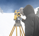
- IP65 dustproof/waterproof performance Standard usage temperature range -20ºC to +60ºC. Low temperature models can be used in range -30ºC to +50ºC.*
* Low temperature models are available as options.
PRIMARY FEATURES
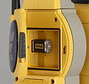
- USB Type A and Type miniB port

- Green/Red Guide Light is built into the telescope as a standard feature, enhancing setting-out work efficiency in a range of 1.3 to 150m.
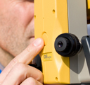
- Trigger key lets you take a series of measurements without taking your eye off the telescope. Trigger key is ergonomically placed so that measurement can be taken at any time with just the push of a button.
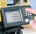
- Control panel consists of 10-key pad with alphab etentry with color LCD touch screen display for easy viewing of graphics*.
* Control panel location may vary depending on region or model.
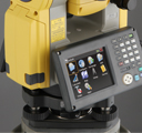
- Long-lasting battery: one battery provides 20 hours of power.
- Built-in laser plummet is equipped for quick instrument setting. 5 brightness levels are ready for optimum visibility.*
* Option.
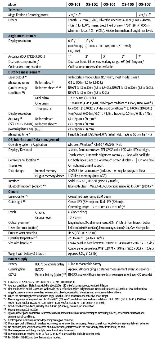
Specifications
ALAM SURVEY
Alamat: Jl.raya Joglo no.68 jakarta Barat
Contact : asep mulyana
simpati : 082119696710
XL : 087809762415
M3 : 085719962482
Fax : 021-5840766
Pin bb : 2691286B
email : asepmulyana120@yahoo.com
website :http://wwwalamsurvey.com :
adalah perusahaan yang bergerak di bidang Sales , service kami menyediakan alat-alat Survey keperluan Pertambangan dan Konstruksi.
Menjual Alat-Alat Untuk Survey Pemetaan, Infrastruktur, Kontraktor, Telekomunikasi, Pertambangan, Geologist, Exploration, Mining, Dirling, Kelautan, Militer, Migas, Pembangunan Pembangunan, Pengelolahan Lahan Lahan Perhutanan Dan Perkebunan Kelapa Sawit.
* Kami hadir untuk melayani pelanggan dalam bidang
* Pertambangan
* Konstruksi
* Telekomunikasi
* Kehutanan
@ALAM SURVEY
Alat survey Total Station Topcon:
Total Station Topcon GTS 102N,
Total Station Topcon GTS 255N,
Total Station Topcon ES 101
Total Station Topcon ES 102
Total Station Topcon ES 103
Total Station Topcon ES 105
Total Station Topcon OS 101
Total Station Topcon OS 102
Total Station Topcon OS 103
Total Station Topcon OS 105
@ ALAM SURVEY
Alat Survey Total Station Sokkia:
Total Station Sokkia Set FX 101
Total Station Sokkia Set FX 102
Total Station Sokkia Set FX 103
Total Station Sokkia Set FX 105
Total Station Sokkia CX 101 ,
Total Station Sokkia CX 102,
Total Station Sokkia CX 103,
Total Station Sokkia CX 105,
Total Station Sokkia CX 107,
@ ALAM SURVEY
Alat Survey Total Station Nikon:
Total Station Nikon DTM 322,
Total Station Nikon DTM 652,
Total Station Nikon NPL 632,
Total Station Nikon Nivo 2M,
Total Station Nikon Nivo 3M,
Total Station Nikon Nivo 5M,
Total Station Nikon Nivo 2C,
Total Station Nikon Nivo 3C,
Total Station Nikon Nivo 5c,
@ALAM SURVEY
Alat Survey Digital Theodolite Topcon :
Theodolite Digital Topcon DT 209,
Theodolite Digital Topcon DT 207,
Theodolite Digital Topcon DT 205,
Theodolite Digital Topcon DT 209L,
Theodolite Digital Topcon DT 207L,
Theodolite Digital Topcon DT 205L,
@ ALAM SURVEY
Alat Survey Theodolite Digital Sokkia
Theodolite Digital Sokkia DT 740,
@ ALAM SURVEY
Alat Survey Theodolite Digital Nikon
Theodolite Digital Nikon NE 100, 10 detik,
Theodolite Digital Nikon NE 101, 7 detik,
Theodolite Digital Nikon NE 102, 5 detik,
Theodolite Digital Nikon NE 103, 5 detik,
@ALAM SURVEY
Theodolite Digital Minds CDT05,
Theodolite Digital South ET02,
Theodolite Digital South ET05,
Theodolite Digital Horizon ET1002,
Theodolite Digital Horizon ET1005,
@ ALAM SURVEY
Alat Survey Waterpass/ Automatic Level Topcon:
Automatic Level Topcon ATB-2, 0.7mm,
Automatic Level Topcon ATB-3, 1.5mm,
Automatic Level Topcon ATB-4, 2.0mm,
@ ALAM SURVEY
Alat Survey Waterpass/ Automatic Level Sokkia
Automatic Level Sokkia B40, 2.0mm,
Automatic Level Sokkia B20, 0.7mm,
Automatic Level Sokkia B30-35, 1.5mm,
@ ALAM SURVEY
Alat Survey Waterpass / Automatic Level Nikon
Automatic Level Nikon AC-2S, 2mm,
Automatic Level Nikon AP-8, 1.5mm,
Automatic Level Nikon AS-2C, 0.8mm,
Automatic Level Nikon AE7,
@ ALAM SURVEY
Alat Survey GPS Garmin :
GPS Garmin 78S,
GPS Garmin 62S,
GPS Garmin Etrex 10,
GPS Garmin Etrex 20
GPS Garmin Etrex 30,
Gps Garmin Oregon 550,
Gps Garmin Montana 650
@ ALAM SURVEY
Alat Survey Gps Mapping:
Alat Survey Gps Mapping
Gps Mapping Trimble Geo XH, Geo XT, GEO XM
Gps Mapping Trimble Juno Juno SB, Juno SC, Juno SD
@ALAM SURVEY
Laser Meter Leica Disto D210
Laser Meter Leica Disto X310
Laser Meter Leica Dsito D510
Laser Meter Leica Disto D810
Laser Meter Leica Disto D8
@ ALAM SURVEY
Alat Survey Geologi / Pertambangan:
Compass Brunton 5008,
Compass Brunton 5006,
Compass Brunton 5010,
Palu Geologi Estwing Pipih/ sediment,
Palu Geologi Estwing Runcing/ Rock,
@ ALAM SURVEY
Alat Survey Suunto Compass:
Compass Suunto KB-14,
Compass Suunto Clinometer PM-5,
Compass Suunto Altimeter E203,
Compass Suunto Tandem ( KB-14+PM5),
@ALAM SURVEY
Service Center Survey Equipment
Service Kalibrasi Total Station Sokkia,
Service Kalibrasi Total Station Nikon,
Service Kalibrasi Total station Topcon,
Service Kalibrasi Theodolite Sokkia,
Service Kalibrasi Theodolite Nikon,
Service Kalibrasi Theodolite Topcon , Leica,
Service Kalibrasi Automatic Level Sokkia,
Service Kalibrasi Automatic Level Sokkia,
Service Kalibrasi Automatic Level Topcon,
Service Kalibrasi Gps Garmin, Gps Magellan, Gps Trimble dan lain-lain.
PENGIRIMAN GRATIS UNTUK WILAYAH DKI

