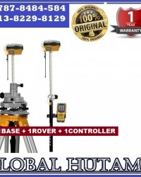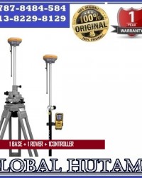
08787-8484-584 Jual Gps Geodetik Epoch 50
Update Terakhir
10-09-2014
Minimum Pembelian
1 Unit
Dilihat Sebanyak
114 kali
Lokasi
Harga
Rp. 1.234
Bagikan
+ Penawaran
Perhatian!
Perusahaan ini terdaftar sebagai Free Member. Hindari melakukan pembayaran sebelum bertemu penjual atau melihat barang secara langsung. COD (Cash On Delivery) atau bertemu langsung dengan penjual merupakan metode transaksi lebih aman.
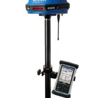
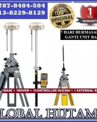
Spesifikasi 08787-8484-584 Jual Gps Geodetik Epoch 50
The Spectra Precision® EPOCH 50 GNSS receiver, with its 220 channels, makes effective use of the GPS L1/L2/L2C/L5 and GLONASS L1/L2 signals for outstanding satellite coverage and precise positioning. EPOCH 50 uses proven technologies to provide both an extremely stable phase center and tracking of the newer L2C and L5 signals.
EPOCH 50 GNSS systems with Survey Pro field software provide field crews with the tools and capabilities to get the job done. With maximum stability, precision, quality, and easy to use work flows, the EPOCH 50 GNSS systems are packed full of proven technologies that you can rely on day-to-day.
The EPOCH 50 GNSS receiver has an internal transmit and receive radio modem so that every receiver may be used as either a base or a rover. Use the internal radio on a construction site for a quick and easy setup. EPOCH 50 also supports external radio and cellular modems for added flexibility and range. In addition, communicate cable free with Bluetooth® to your choice of world-class Spectra Precision data collectors.
EPOCH 50 provides added productivity and cost savings with support of RTK Network technology for single base and NTRIP operations. Connect to networks with Spectra Precision WWAN-enabled data collectors for added flexibility.
Designed with greater than 99.9% reliability initializations, the EPOCH 50 GNSS receiver provides fast, high quality results in all supported survey modes. Consistent accurate results, quality construction, and affordable pricing make EPOCH 50 the ideal choice for a productive business.
Spectra Precision Survey Office software provides a complete office solution for post-processing GNSS data and adjusting terrestrial survey data. Export your processed and completed results directly back to the field or design software packages using a variety of file formats.
Product specifications
- Constellation : GPS/GLONASS/GALILEO/SBAS
- Frequency : L1/L2/L5
- Channels : 220
- Update Rate : 0.05 sec
- Data format : sCMRx, CMR, CMR+, RTCM 3.1
- Raw data output : Yes
- Real-time Accuracy - RTK mode (HRMS) : 1 cm
- Real-time Accuracy - DGPS mode (HRMS) : < 30 cm
- Real-time Accuracy - SBAS mode (HRMS) : < 50 cm
- Post-Processed Accuracy (HRMS) : 0.3 cm + 0.5 ppm
- Communications : UHF, BT, RS-232
- Unit size (mm / inches) : 19.0 x 10.7 x 20.0 cm / 7.48 x 4.21 x 7.87 in
- Weight : 1.34 kg / 2.95 lb
- Display : LED
- Memory : 64 MB
- Temp Min (°C) : -40°C / -40°F
- Temp Max (°C) : +60°C / +140°F
- Waterproof : IP66
- Shock & vibration : MIL-STD-810F
- Power (type - lifetime) : Li-Ion - 4 hours in RTK/Static mode
- Antenna Type : Internal
- Software options : Yes
CV GLOBAL HUTAMA
CV.GLOBAL HUTAMA
Jalan Joglo Raya Taman Alfa Indah Blok F6 No.4 Jakarta Barat 11640
Up: Dani Firmansyah
Phone : 021- 5890 9739
Fax : 021-2944 9921
Mobile : 0813-8229-8129 / 08787-8484-584
Email : glonassindo@yahoo.co.id
Ym : glonassindo
Web : http://www.globalhutama.net
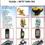
Menjual Alat-Alat Untuk Survey Pemetaan,Kontraktor,Telekomunikasi,Geologi,Exploration,Kelautan,Militer,Migas,Meteorologi, Klimatologi, dan Geofisika,Laboratorium Industri Pembangunan – Pembangunan, Pengelolahan Lahan – Lahan Perhutanan Dan Perkebunan Kelapa Sawit.
CV GLOBAL HUTAMA
Free Member
Jalan Joglo Raya Taman Alfa Indah Blok F6 No.04 Jakarta Barat 11640
Login Terakhir 17-07-2018
02180232870
087878484584
Produk Lainnya

